 | | WV WaterNet: Spring Edition |
| |
|
| Mid-Atlantic Monitoring Conference and WV Watershed Symposium: Register Now! |
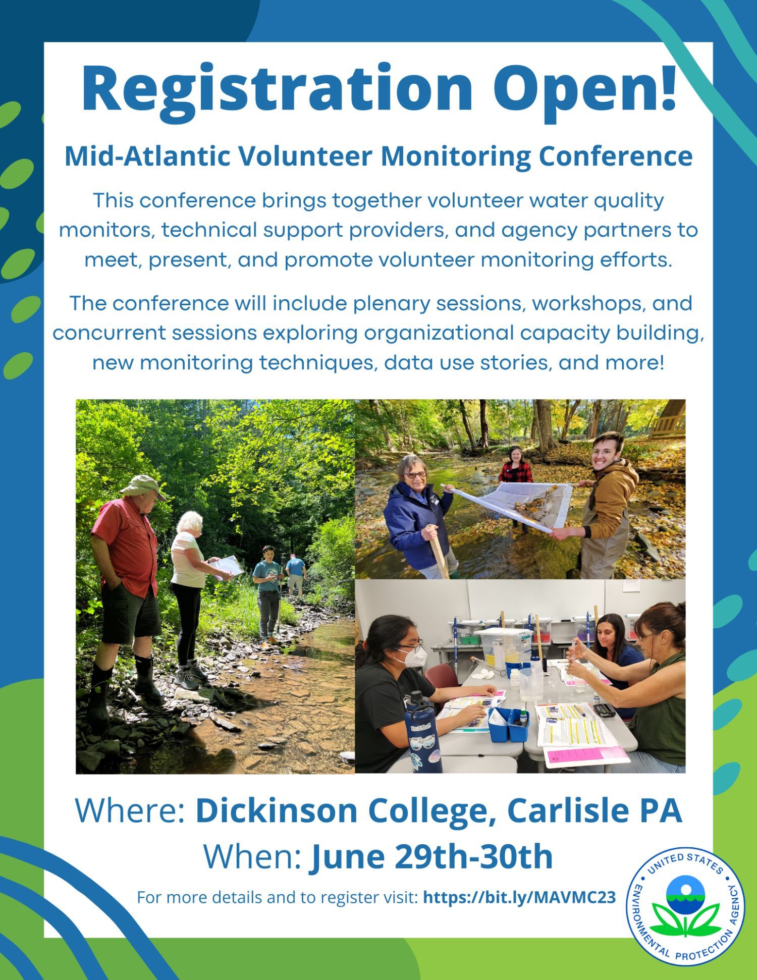
| Registration for the (free!) Mid-Atlantic Monitoring Conference is open. This free conference, held June 29-30th at Dickinson College in Carlisle, PA, brings together volunteer water quality monitors, technical support providers, and agency partners to meet, present, and promote volunteer monitoring efforts. The conference will include plenary sessions, workshops, and concurrent sessions exploring organizational capacity building, new monitoring techniques, data use stories, and more! You can view conference information here and register for the conference here. |
| |
|
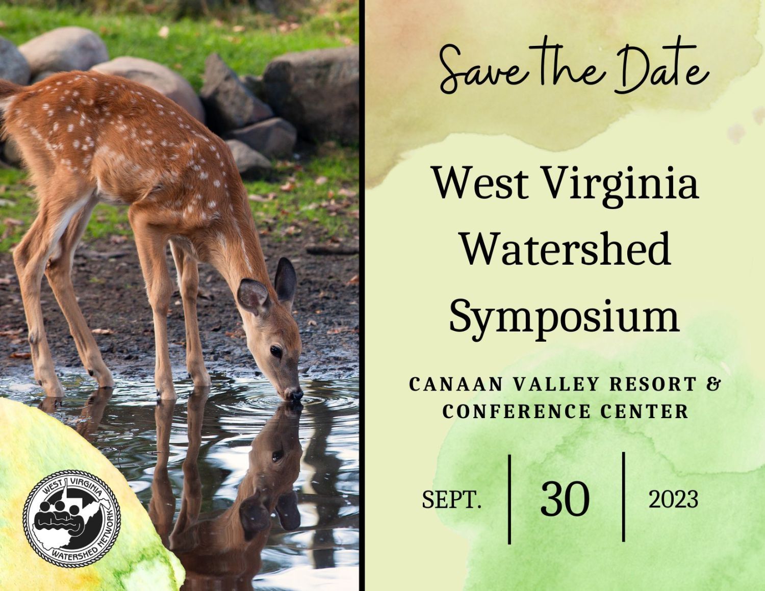
| | Registration is open for the 2023 WV Watershed Symposium. The symposium will be held September 30th at Canaan Valley State Park. Session topics include water trails, stream restoration, as well as USGS and WVU research updates. There will also be time for networking and watershed awards! Register and apply for a travel scholarship here. The deadline to register for the symposium and apply for a travel scholarship is Friday, Aug 11th. |
| |
|
| | | Grants.gov Workshop Join us on Thursday, May 11th for a targeted webinar to walk through the process and understand the relationships between SAM.gov, Login.gov, Grants.gov, and learn some helpful tricks and tips. The workshop will be from 3-5pm. Register here! If there are specific questions or topics that you would like to be covered, please reach out to Jenna Dodson at jdodson@wvrivers.org. |
| | |  | Join ReImagine Appalachia on Wednesday, May 17th, at noon for a workshop on how to use Canva for nonprofits. Canva is a dynamic and pivotal tool that can be used to create flyers, Instagram carousels, Twitter posts, videos, and more! Users of all levels are welcome. This will be an informal, open discussion to learn Canva best tricks and practices. Register here. |
| |
|
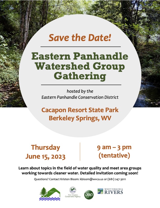
| | | Eastern Panhandle Watershed Group Gathering The Eastern Panhandle Watershed Group Gathering will take place on Thursday, June 15th. Topics include water quality monitoring, fundraising strategies, and newer technologies in the conservation field. A detailed invitation will be sent out closer to the event date. If you would like to receive the agenda and registration information, please fill out this google form. |
| |
|
| Cacapon Riverfest The second annual Cacapon Riverfest returns to Capon Bridge! The festival is a free event coordinated by the Friends of the Cacapon River and hosted by the River House. The incredible two-day celebration includes river activities, environmental education, art, food, and all-day music. Last year over 1,000 people experienced the tremendous festival. The event will take place Friday, June 16 and Saturday, June 17, 2023. New this year will be a Float Parade! The festival will see the return of river activities like a rock skipping contest, homemade boat race and a chance to sit in the river. The nature lecture series will occur at the Capon Bridge library. For more information, contact the Cacapon Riverfest Facebook or Tim Reese at tim@cacaponriver.org. |
| |
|
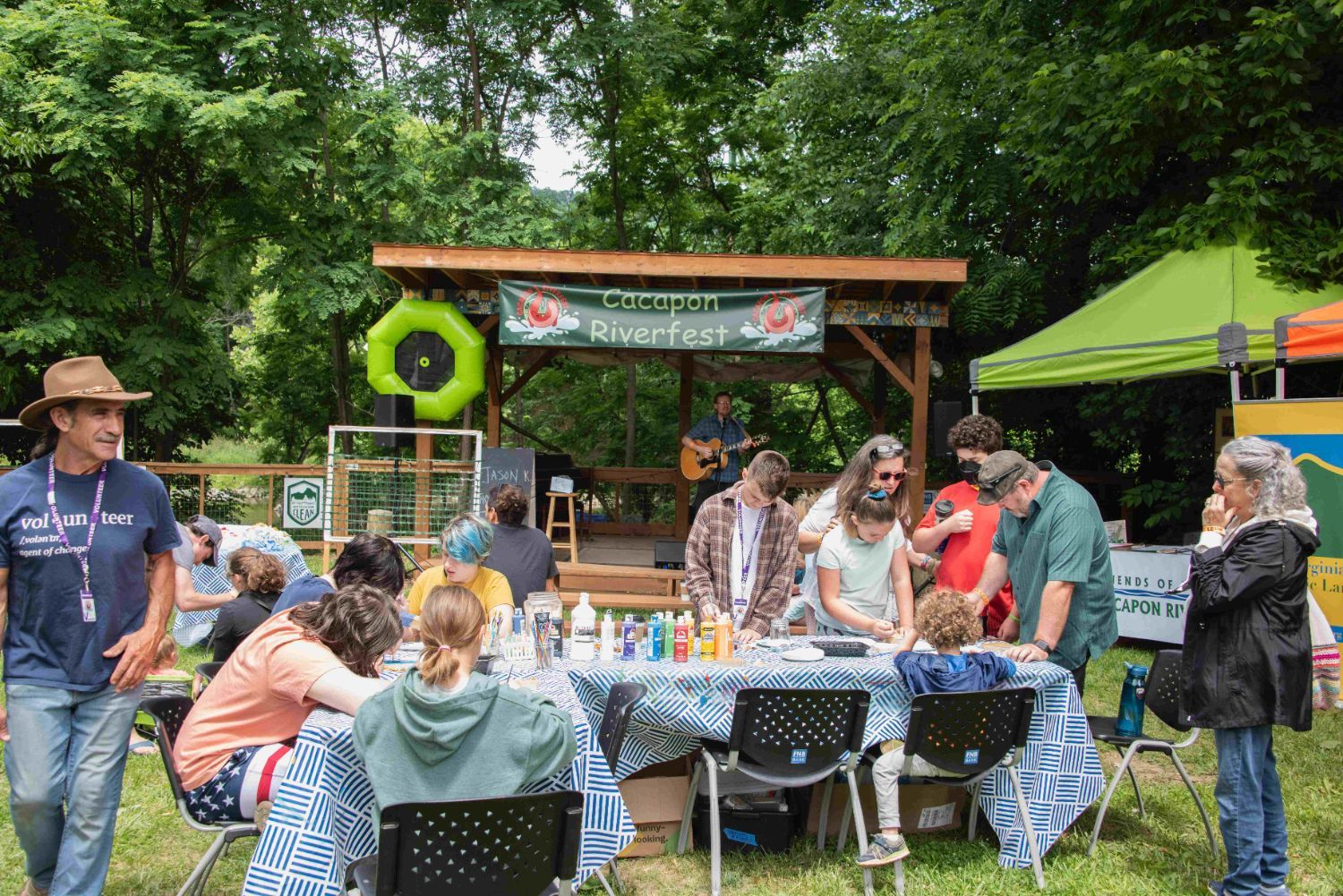 | Cacapon Riverfest-goers at the 2022 celebration |
|
|
| 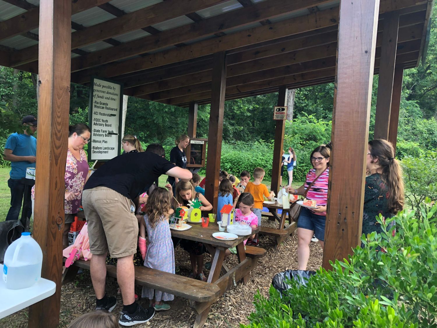 | Community members enjoying arts and crafts at last year's Outdoor Arts Week |
|
|
Outdoor Arts Week The week of June 12-16th, join Friends of Deckers Creek for Outdoor Arts Week, a 5-day series of free environmental education activities for ages 6 and above at the Outdoor Learning Park in Sabraton. These activities will be diverse in content, adaptable for a range of ages and learning styles, and incorporate both environmental education and art. Each day will have a unique theme, including: birds, plants, wildlife, stream science and connection to watershed. For more information, please see the Outdoor Arts Week Facebook event. |
|
|
| |
|
| Mapping the Monongahela Watershed By Jessica Bryzek A collaborative effort is currently underway to tell the story of the Monongahela watershed. The Mon River and tributaries, the West Fork, Tygart Valley, Cheat, and Youghiogheny Rivers, are the main drainage network for north-central West Virginia, southwestern Pennsylvania, and western Maryland. The watershed is a balance of both human and natural areas: bustling urban areas, towns, and cities, rural farmland, and thriving natural ecosystems, including wetlands, forests, deep canyons, and high-elevation plateaus. |
| 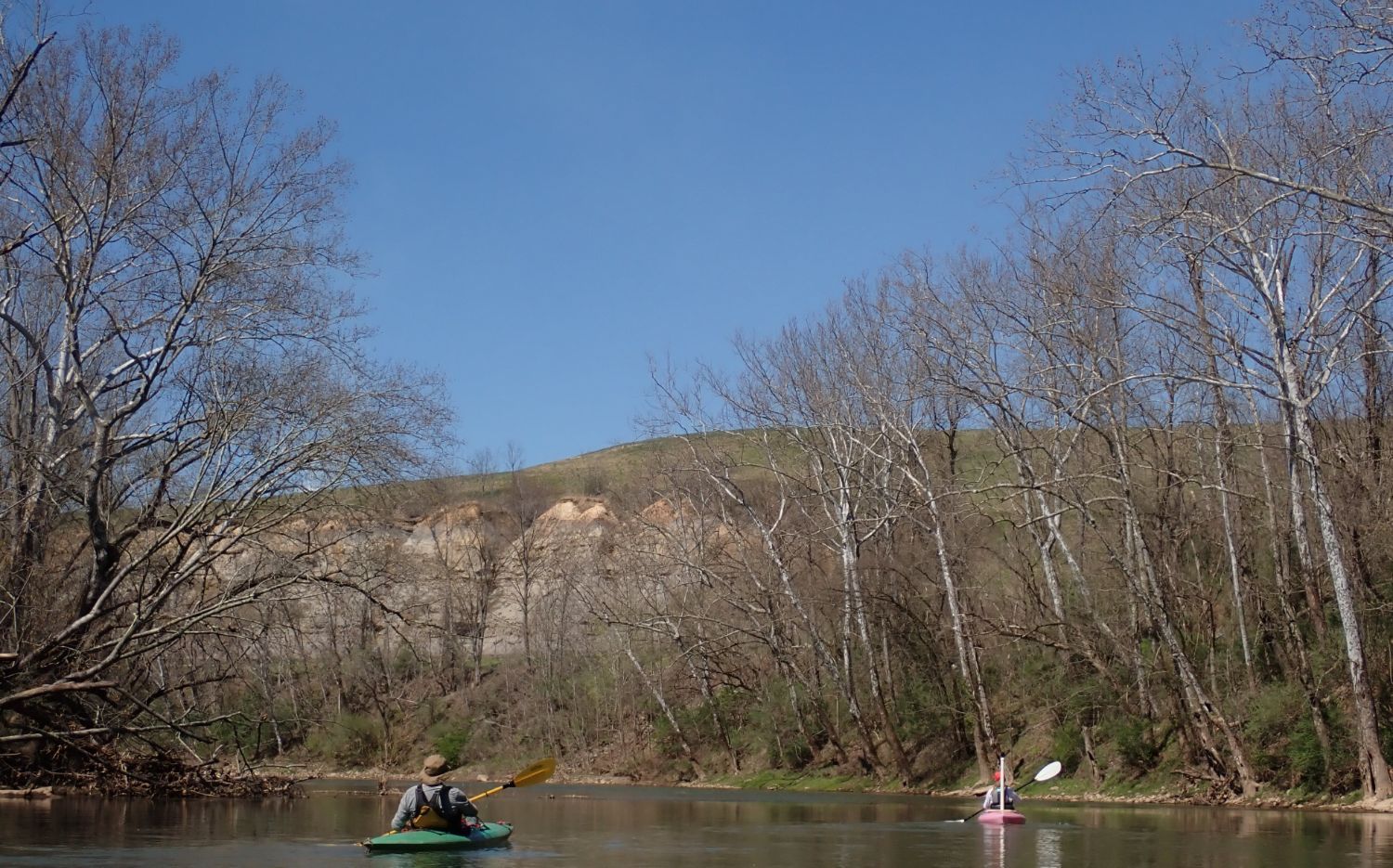 | Volunteer Tom Berlin and AmeriCorps VISTA member Jessica Bryzek paddle the West Fork River downstream of Clarksburg as part of the Monongahela mapping project. |
| The project is composed of two parts: fieldwork mapping and building an interactive story map. Volunteers complete the fieldwork using a Go-Pro camera in time-lapse photo mode to obtain on-the-water imagery while floating downstream. The camera takes a 360-degree, GPS-enabled picture every 10 seconds. Most often, a boat has been used in the Mon mainstem, but a kayak is the preferred craft in small rivers with exciting riffles and rapids. The images become publicly available and function like Google Street Views for streams and rivers. The interactive imagery will be combined with different datasets describing ecological, social, historical, and recreational assets into an ArcGIS Story Map. The imagery and maps will be connected to narrations that give a voice to the wildlife and aquatic critters that call these rivers home. John Detisch, a member of the Izaak Walton League in southwestern Pennsylvania, initiated the project. Motivated by the need to protect our drinking water, John saw this potential project as an opportunity to package many environmental issues into one: a case for clean water is also a case for healthy recreation and ecosystems. He partnered with Earth Views, a technology company that provides the go-pro and handles image data processing. The on-the-water imagery is what makes this project so unique. The high-quality photos allow users to closely examine the riverbanks. Conservation groups can use these photos to identify erosion, tributaries, and seeps with poor water quality and the integrity of riparian buffers. In addition, the public can use the images to plan river trips, scout potential rapids, and identify public access sites. The ArcGIS Story Map can also be used for educational purposes. For example, students in the watershed could learn how their hometown river functions as part of a larger watershed. Overall, this project is an all-in-one opportunity: volunteer participation, public engagement, education, asset mapping, and community storytelling. |
| 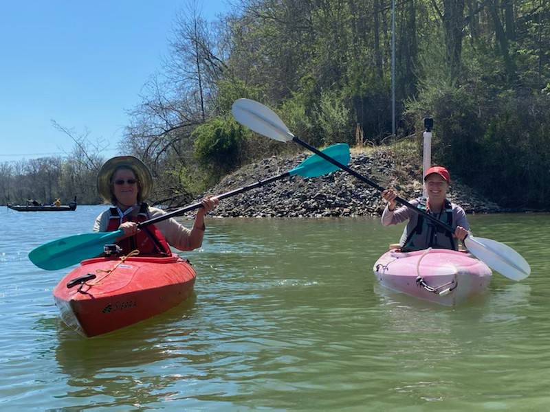 | Volunteer Peggy Pings and AmeriCorps VISTA member Jessica Bryzek celebrate at the confluence of the West Fork and Tygart River in Fairmont. Both Peggy and Jessica completed the entire water trail. |
| In April, three volunteers and I completed mapping for the West Fork River. We completed the entire 75-mile West Fork River Water Trail in 8 paddling days. Starting at the Stonewall Jackson Reservoir tailwaters, we floated through remote forested sections and cities such as Weston, West Milford, Clarksburg, Shinnston, Worthington, and ending in Fairmont. We traveled to each river bend, exploring the natural beauty, wildflowers, and wildlife that call the river home. To experience the landscape from the river’s view is a true treasure, and I hope this project empowers individuals to learn the story of their watershed. Check out the progress for the Monongahela mapping project here: https://arcgis.earthviews.com/public/monongahela-west-fork-040623#4 |
| |
|
| |
|
| | West Virginia Rivers Coalition
3501 MacCorkle Ave SE #129 | Charleston, West Virginia 25304
304-637-7201 | wvrivers@wvrivers.org |
| The WV WaterNet is made possible through an award of Environmental Protection Agency’s 319 funding awarded to the West Virginia Rivers Coalition by the West Virginia Department of Environmental Protection. |
| | |
|
| |
|
|